What is happening?
September 2022 -- A large contingent of the Purdue I-GUIDE team was busy at the I-GUIDE HDR Institute all-hands meeting in Chicago, September 8-9, sharing our latest work on convergence science, cyberinfrastructure, education and training development with the multi-institutional I-GUIDE team. The I-GUIDE platform was featured at the meeting.

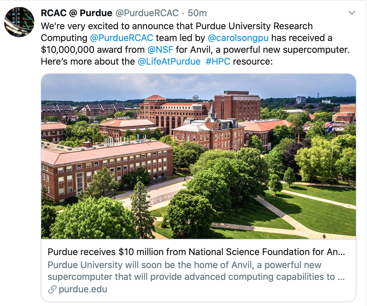
November 15, 2021 -- It is the week of Supercomputing 2021! Read Purdue's news release about its new NSF-funded supercomputer Anvil and our vendor partner AMD's newly published case study on Anvil based on interviews with the Anvil team.
October 19-21, 2021 -- The SSG staff made four presentations at the annual Gateways conference - check out the titles of their presentations in our most recent newsletter below.
October 2021 -- Carol leads the Purdue team in a $15M NSF Harnessing Data Revolution (HDR) Institute grant, led by UIUC, to establish I-GUIDE
September 15, 2021 -- Rajesh is Co-PI to a recent $1M NSF Award To Develop AI For Reconstructing Unexplored Archeological Sites In VR
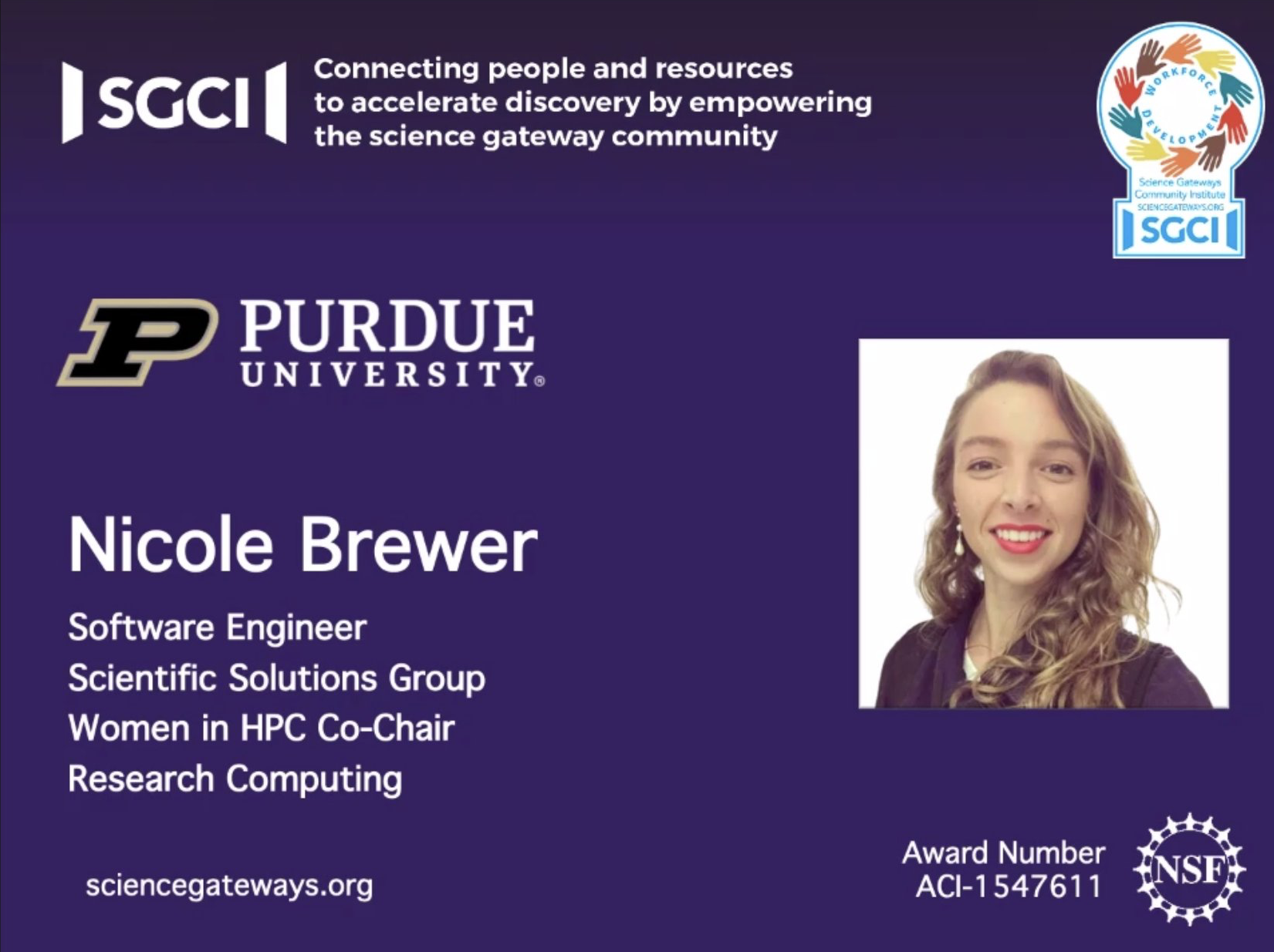
October 19, 2020 - Congratulations to Nicole Brewer for being awarded the Young Professional of the Year title at Gateways 2020!
September 2020 -- SSG is part of the Purdue team with a new $2 million NSF grant to create the GLASSNET global network for sustainability research and education!
June 30, 2020 -- Check out two presentations by the SSG members on the GeoEDF data framework design and Science Gateway for CyberTraining at the virtual PEARC20 conference, July 27 & 28!
May 2020 - Purdue Research Computing will develop a new advanced computational resource for the nation's science and engineering community! (news release)
May 2020 - Congrats to Nicole Brewer (SSG team member) for being accepted to the San Diego Supercomputing Center's Summer Institute 2020!
April 2020 - Congrats to Jungha Woo (SSG team member) for being accepted to the NCAR's Artificial Intelligence for Earth System Science (AI4ESS) Summer School!
October 1, 2019 - SSG is proud to be part of this new NSF INFEWS project to tackle new challenges in the nexus of food, energy & water!
September 25, 2019 - MyGeoHub used in the "Multi-scale Analysis of Sustainability" short course for international researchers and sustainability research
September 1, 2019 - New undergraduate students join SSG in the fall semester!
July 25, 2019 - Our DURI undergrad interns will present their work at the Purdue Summer Research Symposium
July 11, 2019 - Purdue generates more than a half-billion dollars in research funding this year
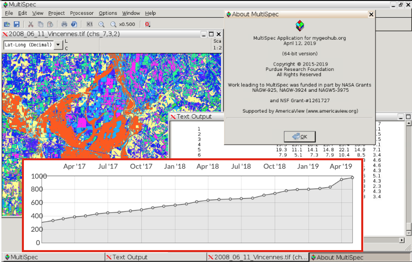
April 18, 2019 - 30th Anniversary of MultiSpec Image Processing Software, still widely in use!
January 17, 2019 - ScienceNode article about our new GeoEDF platform driven by scientific needs
September 4, 2018 - Ph.D. Student, Jaewoo Shin, Excels with MyGeoHub.org
April 3, 2018 - Ya-Wen Chu, the GLASS project Spring 2018 DURI intern
September 13, 2017 - Internships in ITaP Research Computing’s Scientific Solutions Group boost student success
July 26, 2017 - Two ITaP Research Computing teams win awards at national conference
July 7, 2017 - ITaP staff presenting at an advanced research computing conference
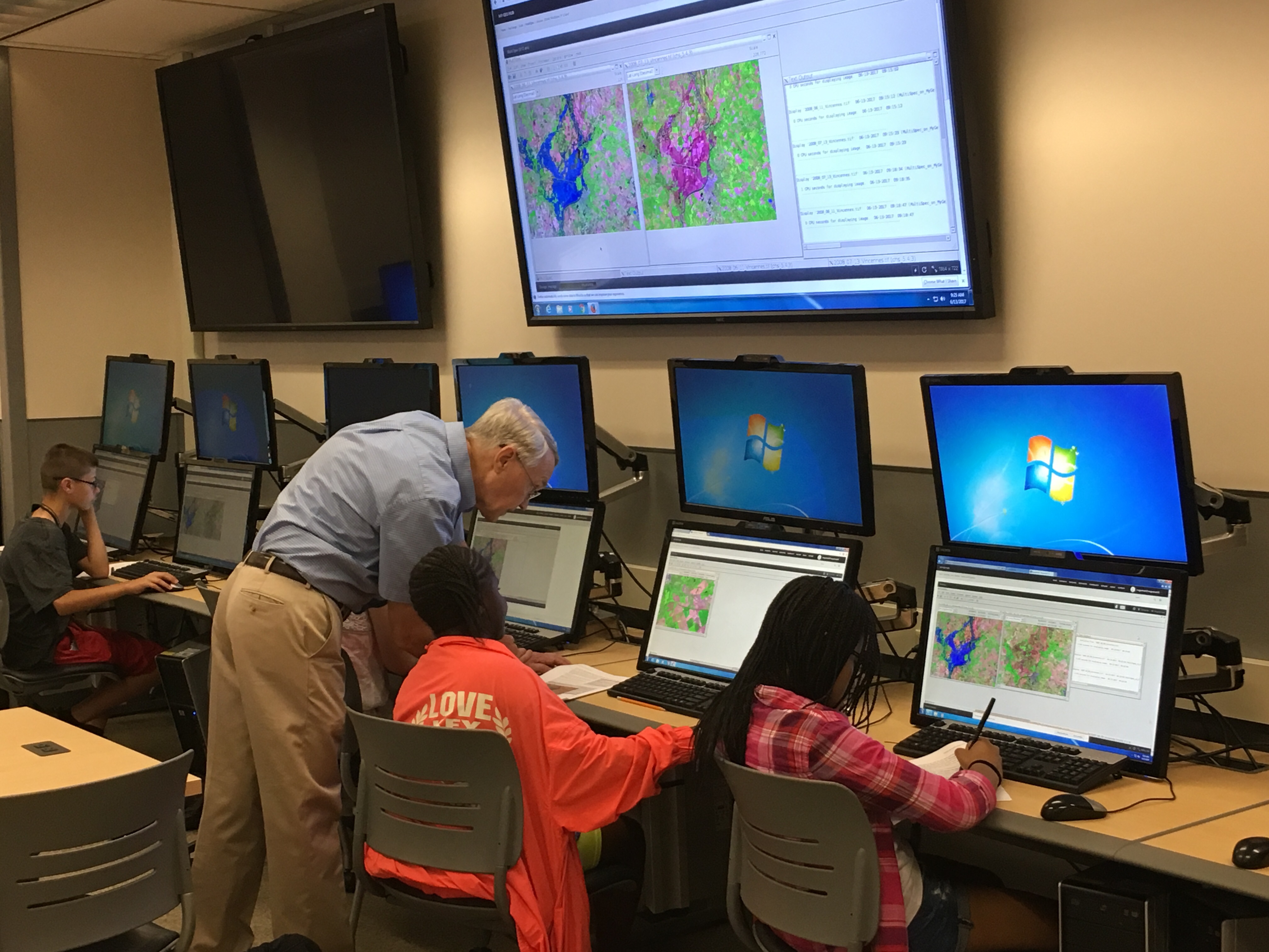
July 5, 2017 - Students learn about geospatial data analysis, virtual reality through Research Computing summer outreach
Newsletters to RCAC
Scientific Solutions in Byte Size, October 31, 2021
We have much good news to share and I’d like to start with the latest bits.
First, we are very excited about two new large projects that have been funded this month:
- Purdue is a major partner in a 5-year $15M NSF award to establish an HDR (Harnessing Data Revolution) Institute led by UIUC. Carol is the Purdue PI of this project and is excited that the Purdue team brings diverse expertise from Civil Engineering, Ag Econ., Industrial Engr./Political Sci., Statistics, Data Visualization (CGT) and Cyberinfrastructure to this HDR Institute (Purdue subaward ~$2.5M). Carol is co-leading the CI core and our role is to develop and integrate geospatial CIs to enable the research agenda of the institute and engage the broader community. If interested, you may check out the NSF award page and project website. Purdue announcement is pending.
- Purdue just announced a $1M NSF award for a collaborative project led by Daniel Aliaga (PI, CS), Ian Lindsay (Co-PI, Anthropology) and Rajesh Kalyanam (Co-PI, RCAC) along with archaeologists from Vanderbilt and Brown Universities. They will utilize deep learning to reconstruct archaeological sites in 3D from satellite imagery. Rajesh will help deploy the processing pipeline and set up the integration between the GeoPACHA archaeology portal and MyGeoHub where the data and tools will reside, respectively.
More good news on the funding front, including:
- Lan is the PI of a subaward from KSU, a grant from USGS that will support the update of the popular AgMIP Data Aggregator application which was first developed several years ago as part of the Geoshare project. The AgMIP aggregator has been the 3rd most popular tool on MyGeoHub following MultiSpec (#1) and Jupyter Notebook (#2).
- The NHERI (natural hazards engineering research infrastructure, aka NEES follow-on) Coordination Office has been renewed in August for 4 more years, where Chris continues to serve as the office’s technology specialist.
Highlights of recent developments in our projects.
- Most recently, our SACI platform (sensor data analytics CI) is being used to support real-time data ingestion from manufacturing machines as part of the Cybersecurity Manufacturing Innovation Institute (CyManII). A testament to the quality of the platform: More than 4 million records were ingested into SACI on its first weekend of receiving data! This opens new areas for collaboration in SACI in addition to its support for research and teaching in Ag and Ecology. Great work, Jaewoo and Lan!
- The GeoEDF data framework (connector/processor framework & workflow engine) Release 1 has been released on MyGeoHub. A containerized standalone testbed is also available for development. The project team met at an in-person retreat in mid-August to review our progress and plan, as well as brainstorm on new ideas. We just submitted our Y3 annual report, thanks Team!
- We have been developing the Superpower online tool (aka a statistical power calculator on steroids) as part of a NIH project led by Purdue Psychological Sciences over the past three years and are getting ready with Release 1 thanks to efforts by Nicole, Rob and I Luk (and in the early stage, Jaewoo).
- Following the JN-based online tool AgMIP GlobalEcon Data Explorer (different from the data aggregator mentioned above) developed by Rob, our summer DURI student Raziq has created a new companion tool for data contributors to submit their datasets following streamlined steps that includes validation, cleaning, and error diagnosis. Both tools are published on MyGeoHub and are being tested by the AgMIP team. You may view Raziq’s video here for his DURI presentation.
- Gaurav Sachdev (CS graduate student) joined us and is working under the supervision of Jungha to transition the SIMPLE-G Ag Econ model online tool to Jupyter Notebook with new features. David (Haotian) Deng (CS graduate student), supervised by Lan, joined us to work on geospatial data apps. Currently, he is helping fix some of our geospatial data viewer tools and creating tutorials.
Closing out on the following projects:
- HazardSEES – The project is ending soon. Chris has worked with the team on software development and most recently worked to transform their hurricane evacuation simulations into services for integration with a science gateway.
- NEXUS Purdue-UNSA – We completed three web-based tools for the SWM team (led by PIs Bowling, Cherkauer): HidroAQP (flow info visualization), Cultivista (hi-res satellite image data processing, classification and visualization), and AQP-Clima (access and visualization of historical climate data). All tools work with data specific to the Arequipa region in Peru. This concludes our work in Phase 2 of the project. These tools are featured on our group’s Gallery page.
On Publications, congratulations to Jungha and Lan on their journal paper titled “Streamlining Geospatial Data Processing for Isotopic Landscape Modeling”, accepted to appear in a special gateways issue of Concurrency and Computation: Practice and Experience (CCPE). Lan and Jaewoo are co-authors on a journal paper titled “PIOT-Hub: Collaborative Cloud Tool for Generation of Physical Input-Output Tables Using Mechanistic Engineering Models” accepted for publication in the Journal of Industrial Ecology.
In addition, several submissions to the Gateways 2021 conference have been accepted for oral and video presentations:
- Christopher Thompson, Satish Ukkusuri, Hemant Gehlot, Zengxiang Lei, Rajat Verma, Jaiwei Xue, Xinwu Qian, Xianyuan Zhan, Shawn Rice, and Carol Song. The Development of A-RESCUE Online Task Management - Leading Researchers to Scientific Gateways. Gateways 2021. Accepted for presentation.
- Nicole Brewer. Leveraging Traits for Highly Interactive Computational Tools in Jupyter. Gateways 2021. Accepted for video presentation.
- Rajesh Kalyanam, Rob Campbell, Jungha Woo, Nicole Brewer, Lan Zhao and X. Carol Song. Design and Deployment of Event-based File Processing in a Gateway. Gateways 2021. Accepted for video presentation.
- Rob Campbell, Rajesh Kalyanam, Lan Zhao and X. Carol Song. A Template for Rapid Development of Interactive Computing Tools. Gateways 2021. Accepted for video presentation.
Other publications:
- Sandra Gesing; Claire Stirm; Gerhard Klimeck; Lynn Zentner; Su Wang; Braulio Misael Villegas Martinez; Carrie Diaz Eaton; Sam Donovan; Lan Zhao; Carol Song; I Luk Kim; Alejandro Strachan; Michael Zentner; Rajesh Kalyanam. “Open Science via HUBzero: Exploring Five Science Gateways Supporting and Growing their Open Science Communities”. Human-centricity in a Sustainable Digital Economy; The 55th Hawaii International Conference on System Sciences (HICSS-55). Accepted for publication.
Our effort on proposals didn’t let up either. From Nov. 2020 through Sep. 2021, the SSG staff spent significant efforts on 9 proposals and contributed to several other proposals, including several large NSF and NIH proposals that are still pending:
- NIH Bridge2AI center’s Tool Optimization Core proposal, led by OSU. Carol and Rajesh are co-investigators. The total Purdue (ITaP) proposal is $620K to support investigator effort and software development.
- RCAC participated in several NSF ACCESS track proposals. SSG staff focused efforts on an ACO proposal led by IU, a Track 2 proposal led by TAMU, and a Track 5 proposal led by CWRU. Great opportunities to work with a broad set of collaborators.
- Lan is CoPI in collaboration with UT Kingsville on a NASA proposal to develop the “HydroFlame” platform to better manage water resources after wildfires.
Scientific Solutions in Byte Size, July - October 2020
Another installment of the Scientific Solutions bytes to share with RCAC colleagues! As always, we welcome questions and comments.
Highlights
This year’s Gateways conference was, like every other conference, conducted virtually with activities spread out during October 12–16 & 19–23. SSG staff presented 4 exciting tools/projects: GeoEDF geospatial data framework, SWATShare online hydrologic modeling and model sharing, IsoMap isotopic landscape modeling, and SACI sensor data analytics cyberinfrastructure! Congrats to Rajesh, I Luk, Jaewoo, Jungha for the great work and presentations! Nicole was awarded the SGCI Young Professional of the Year title---a wonderful recognition and opportunity for Nicole!
Our work on the NEXUS (Purdue-Arequipa, Peru) project has led to three interactive data exploration and visualization tools, Climate Data Viewer (U2U tool adapted, Rob), HidroAQP (SWATFlow adapted for the Arequipa, I Luk/Lan), and CultiVista (crop monitoring, I Luk/Lan). We are wrapping up the work for this phase of the NEXUS funding. Additional development is being planned if/when Purdue wins another round of the funding in this program.
We are excited about a new IN DNR project that has recently been funded (PI Pat Zollner, FNR). This project will translate the research on the spread of chronic wasting disease, CWD (in deer population) in IN from IL into an online tool for public access. Our work will kick in during the second year and will create a geospatial web application on MyGeoHub for users and state agencies to investigate and learn the effectiveness of different management scenarios at mitigating the disease.
The GeoEDF project is making progress toward full deployment on MyGeoHub by the end of 2020. Since the summer, the framework software was released as beta for integration test (available in github). It has been tested by our CoPI Jack Smith (Marshall University) with his water quality use case. The team is actively planning for the next advisory board/stakeholder meeting early next year.
Also worth sharing is the news that we are decommissioning DiaGrid.org and this process should be completed by December 2020. According to my old email, DiaGrid.org started almost 10 years ago! It started as a “science-as-a-service” idea utilizing the abundant amount of idle cycles in our systems via Condor and PBS back then. Several popular tools, including CCSM, Gromacs, NAMD, PyMol, Blaster, CryoEM and SubmitR, were embraced by a significant number of researchers and students both inside and outside Purdue and were used in XSEDE ECSS projects and training events. With the rapid technology changes, especially in the last five years, these applications have evolved too, e.g., moving to GPUs and cloud platforms, use of Jupyter Notebook. As part of the process, several projects are being transitioned to MyGeoHub and JetStream. A new group, CompuHub, now exists on the Purdue CommunityHub where some useful tools on DiaGrid could be migrated to in the future.
Proposals
The team has been productive in submission August - early November, putting in a total of 9 proposals totaling $8M+ in budget. The list includes:
- NSF RI Core medium proposal (Rajesh, CoPI) in collaboration with Purdue CS, CLA, and Vanderbilt and Brown U, on deep generative modeling for urban and archaeological recovery.
- NSF CSSI Element: SIDEREAL: Satellite Imagery Declassified and Exploitable for Research of Altered Landscapes is a collaborative Elements proposal between Purdue and the University of Arkansas to orthorectify and georeference historical satellite imagery via interactive workflows for use by archaeologists and anthropologists. Rajesh is PI and Profs. Ian Lindsay and Andrew Flachs from the Department of Anthropology are Co-PI and Senior Personnel.
- NSF CSSI Element: PIER: A Materials Research Workbench to Bridge the Scientific Community is an Elements proposal to develop a personalizable and extensible personal CI for collaborative data-driven materials science research. Carol is PI and Rob is Senior Personnel. Materials Science faculty Haiyan Wang and Edwin Garcia are Co-PIs.
- NSF CSSI Framework: PeerPresQT: Improving Preservation Quality and Data Sharing in a Peer-to-Peer Model using FAIR principles, aimed at developing novel services that allow users from researchers to data curators to publishers to seamlessly share and preserve data. It is a collaborative proposal led by Prof. Sandra Gesing @ Notre Dame U. Lan is the Co-PI.
- NSF Disaster Resilience Research Grant (DRRG) proposal (Rajesh CoPI, with PI Aliaga and Niyogi). The project proposes to utilize deep learning to analyze satellite imagery to derive building and urban morphology parameters to carry out what-if simulations on heat waves and mitigation strategies.
- Lan and Jungha worked with Professor Bataille (University of Ottawa) on a proposal submitted to the National Geographic Society AI on Earth program. The project’s goal is to incorporate an Azure-based AI framework into the IsoMAP portal that allows users to rapidly generate, store, distribute, and document their own high-resolution Sr isoscapes.
- NSF LEAP HI: Cyber-Infrastructure and Dual Pricing Mechanisms for Agile and Modular Manufacturing Networks (PI Singh, ABE). Carol is CoPI. Other CoPIs are in Industrial Eng, Chem Eng.
- Rajesh participated as senior personnel in a DoD proposal on research around countering misinformation led by Sorin Matei (CLA) and CS faculty members.
Papers, Presentations & Tutorials:
In addition to our Gateways demonstrations in October, we also submitted/co-authored/presented:
- V. Merwade, M. Huber, C.X. Song, L. Zhao, S. Dey, and J. Joseph. CyberTraining Modules for Findable, Accessible, Interoperable, and Reusable (FAIR) science in Water and Climate. Session ED029 - Teaching Research with Programming, AGU Fall Meeting 2020. Submitted.
- Lan and Jaewoo are co-authors of a PIOThub paper submitted to the Journal of Industrial Ecology, titled “Automating the development of Physical Input-Output Tables via Engineering Models Simulation and Physical Supply Use Tables: PIOT-Hub: An Integrative Simulator and Collaborative Cloud Infrastructure”.
- Lan, I Luk and our faculty collaborator Prof Merwade demonstrating SWATshare to potential users/collaborators in Australia and Uruguay.
- I Luk and Lan gave a tutorial to the FAIR Fellows (cyber training) on how to develop and share scientific tools on MyGeoHub and are working with the fellows to help them bring their modeling tools online on MyGeoHub.
Scientific Solutions in Byte Size, April - June 2020
While working remotely is not ideal, the Scientific Solutions (SSG) staff has taken it in stride and made a lot of progress in the past three months. This newsletter is a bit long and we hope you’ll read through – we are excited to share our on-going efforts and results with you all!
First off, we have taken advantage of many learning opportunities – virtual conferences, webinars and training -- among them, Jungha was accepted and attended the NCAR’s AI for Earth System Science summer school June 22-26, learned about decision trees, Artificial Neural Networks, Convolutional Neural Networks, and the newer generative models and encoders and also participated in the hackathon. Nicole has been accepted to the SDSC Summer Institute 2020, Aug. 3-7, through a competitive application process. This will be online due to COVID19. We also contributed to the successful WHPC virtual panel titled “Who is WHPC?” – Carol, Lan, Tsaiwei and Nicole were on the panel moderated by Carolyn. 26 people attended the panel, including several non-Purdue participants!
New Students
We have several new students working with SSG staff this summer, all working remotely ---DURI intern Raziq Ramli (CS sophomore) works with Jungha & Lan to develop a Jupyter Notebook version of the SIMPLE-US tool (ag economic model) to make it easier to use and maintain. DURI internTrishank Rao (CS junior) works with Rajesh on the CHEESE project using ELK to process API logs in usage analysis and developing an instructional Jupyter notebook demonstrating the use of ML analysis of network traffic data for detecting anomalies and attacks such as DDoS. CIT Master’s student Nivedita Nighojkar joined us and she is developing reusable Python-based building blocks for the GeoEDF project.
Project Highlights
Rob worked with Prof. Wisecaver’s group and created the CoExplorer data publication tool, a standalone, container-based web application that allows researchers to query, visualize, and download genomics data. The resulting Docker/Viola/Jupyter based solution, currently hosted by the RCAC HPC team, could serve as a template for future data publication tools.
Supporting the Purdue NEXUS’ SWM team, we are working on three new applications:
- The Arequipa Climate View is a web app that helps users visualize, compare, and download historical climate data for the Arequipa region of Peru. This app is an adaptation from the previous U2U Ag Climate Data tool. MultiSpec was used to compose the data files. More info on the project, team, and data sources is here.
- I Luk and Lan created the NEXUS HidroAQP tool to provide high resolution river flow information (e.g. stream flow, average, trend, comparison) for enhanced water resources management, education, and research. This tool was adapted from the SWATFlow tool previously we developed for WaterHub.
- We are beginning to develop a 3rd tool for this group. The Crop Monitoring Tool will ingest monthly high-resolution satellite imagery (typically RapidEye or PlanetScope) for two regions in Peru, pre-process and classify those images based on a ground reference database, and deliver summary diagnostics in a GUI.
Rajesh presented work done on containerization and benchmarking of the WRF weather simulation model on Google Cloud as part of the ECAS project presentation titled “Building Clouds: Worldwide Building Typology Modeling from Images” led by Profs. Daniel Aliaga and Dev Niyogi for their Phase 1 Internet2 ECAS grant. Rajesh also helped with drafting the Phase 2 proposal.
Publications
We had a large number of submissions in the first half of the year and almost the same number of acceptances, including those accepted and presented at PEARC20 and Gateways20 conferences:
- R. Kalyanam, L. Zhao, C. X. Song, V. Merwade, J. Jin, U. Baldos, J. Smith. GeoEDF: An Extensible GEospatial Data Framework for FAIR Science.
- M. Bhatt, R. Kalyanam, G. Nishida, L. He, C. May, D. Niyogi, D. Aliaga. Design and Deployment of Photo2Building: A Cloud-based Procedural Modeling Tool as a Service. PEARC 2020 student paper.
- L. Zhao, C. X. Song, L. Biehl, V. Merwade, M. Huber, J. Liu, U. Baldos, and I. Shunko. Building a Gateway Infrastructure for Interactive Cyber Training and Workforce Development.
- R. Kalyanam, L. Zhao and C.X. Song. GeoEDF: A Plug-and-play Workflow Framework for Earth Science Research. Gateways 2020.
- J. Shin, L. Zhao, C.X. Song, R. Kalyanam, and J. Jin. SACI - A Cloud Based Real Time Sensor Data Management and Analysis Platform. Gateways 2020.
- Kim, L. Zhao, C. X. Song, V. Merwade, A. Rajib. SWATShare: A Collaborative Cyberinfrastructure for Hydrologic Research and Education Using SWAT Model. Gateways 2020.
- J. Woo, L. Zhao. IsoMAP - A Science Gateway for Isotopic Landscape Modeling. Gateways 2020.
- R. Kalyanam, B. Yang, C. Willis, M. Lambert, and C. Kirkpatrick, “CHEESE: Cyber Human Ecosystem of Engaged Security Education IEEE Frontiers In Education (FIE) 2020 Conference.
- Lan Zhao, Carol Song, Ilya Shunko & Steve Clark. Abstract: Suit Up Your Gateway for Interactive Cyber Training. The 12th International Workshop on Science Gateways (IWSG20). June 11, 2020.
- AGU session proposal titled “Software Cyberinfrastructure in Support of Geoscience” was submitted in collaboration with Kenton McHenry from NCSA, UIUC.
- J.Woo, L. Zhao and G. Bowen. Streamlining Geospatial Data Processing for Isotopic Landscape Modeling. Concurrency and Computation: Practice and Experience. Submitted.
The last category, but definitely not least, is the grants awarded and submitted:
The most notable is the $10M Anvil HPC system awarded in May (this may be the second largest grant Purdue has received in FY just ended on 6/30/20) – a big win for the RCAC team and Purdue.
We also received words that two other NSF grants that SSG partnered are being recommended for funding:
- A CCRI proposal (total $1.7M, PI Bagchi), a follow-up to the FRESCO system data repo project, a collaboration with TACC. Carol and Rajesh are co-PIs.
- An AccelNet proposal to establish GLASSNet: a network of networks in sustainability research ($2M, PI Hert el). Carol is co-PI, Lan sr personnel.
Proposals submitted during this quarter include:
- NSF Convergence Accelerator Phase 1 proposal (PI Guang Lin; Carol & Rajesh co-investigators), submitted May 11
- NSF SitS “Self-powered Soil Sensing System for Smart Agriculture Enabled by Printed Electronics and Flexible Cyberinfrastructures” (led by MSU, Purdue Dr. Jin, Song, Zhao), $1.2M, submitted May 20
- NSF Cyber Physical Systems (CPS) proposal titled “CHEF: A real-time multi-scale crop health evaluation framework” led by Prof. Jian Jin (Purdue ABE), $1.2M. Lan is Co-PI and Rajesh Senior Personnel. Submitted June 22.
Scientific Solutions in Byte Size, January 1 - March 31, 2020
The SSG team was quite busy in Jan/Feb but now that feels like quite a different world long ago. Still, we want to share what we’ve been working on in the first quarter of 2020 and would love to hear any comments and feedback you may have!
First and foremost, two members of our project teams have left Purdue in Q1. Marisa had been the XSEDE Campus Champions coordinator and the outreach coordinator for the NSF GeoEDF project for the past few years. She left Purdue to join the ASU research computing for a wonderful opportunity in January and we are grateful to her many contributions! Larry Biehl, after a 45 yr highly accomplished career at Purdue, retired at the end of February. His MultiSpec software lives on, nonetheless, as we are seeing a surge of new users/classes that have signed up on MyGeohub to use MultiSpec Online recently. We are doing our best to fill Larry’s multiple roles in various projects. It was great to “see” Larry at the U2U virtual happy hour Thursday this week!
We'd also like to share with our RCAC colleagues the SSG team’s overall achievements in the past year, including:
- a total of 23 proposals submitted (4/1/19 - 3/15/20) representing ~$32M in total budget with ~$14.6M allocated for ITaP, including 15 federal grants where SSG staff served as PI, CoPI or Sr Personnel
- Recharge revenue is projected to be $350K (FY20), an increase of ~90% over FY19 revenue
- $3.2M awarded to SSG staff during the most recently completed FY, with $1.5M yearly award expenditure
- The team currently works on 18+ sponsored projects with impacts across multiple disciplines and national boundaries.
Specifically during the first quarter:
SSG staff collaborated with faculty on several large proposals and made significant contributions from conceptualization to writing and wrangling the process, with the following submissions:
- NSF CCRI Open Computer System Usage Repository and Analytics Engine (PI: Bagchi, co-investigators from RCAC: Carol, Rajesh, Stephen H; total budget: $1.5M, submitted 1/9/20)
- NSF AI Institute Planning: AI-Expedited Hybrid Materials Discovery via Materials Data Framework (PI: Edwin Garcia, RCAC investigators: Rajesh, Carol; total budget $1M, submitted 1/30/20)
- NSF AccelNet GLASSNET: Networking Global to Local Analyses to Inform Sustainable Investments in Land and Water Resources (PI Hertel, RCAC investigators: Carol, Lan; total budget $2M, submitted 1/31/20)
- NSF Biology Integration Initiative (BII), Prof. Jacob Hosen, ecology (collaborative proposal with Harvard, etc, RCAC developer support included; submitted 2/6/20)
- Partner on Pat Zollner’s DNR proposal to the Indiana state (developer support budgeted) submitted at the end of February
Papers, presentations submitted:
- R. Kalyanam, L. Zhao, C. X. Song, V. Merwade, J. Jin, U. Baldos, J. Smith. GeoEDF: An Extensible GEospatial Data Framework for FAIR Science. PEARC 2020, submitted
- L. Zhao, C. X. Song, L. Biehl, V. Merwade, M. Huber, J. Liu, U. Baldos, and I. Shunko. Building a Gateway Infrastructure for Interactive Cyber Training and Workforce Development. PEARC 2020, submitted.
- R. Kalyanam, C. Willis, M. Lambert, B. Yang, C. Kirkpatrick. CHEESE: Cyber Human Ecosystem of Engaged Security Education. PEARC 2020, submitted.
- M. Bhatt, R. Kalyanam, G. Nishida, L. He, C. May, D. Niyogi, D. Aliaga. Design and Deployment of Photo2Building: A Cloud-based Procedural Modeling Tool as a Service. PEARC 2020 student paper. submitted.
- EarthCube annual conference - oral presentation abstract submitted
Also worth mentioning: Nicole has stepped up in coordinating the Women in HPC program since Marisa’s departure. She has also assumed more responsibility on our NIH project “Superpower” – she has been working with a group of undergraduate students to better manage the development and testing of the statistical analysis R scripts for the project, and is also taking over the Superpower GUI tool development.
One of Carol's major activities in Feb. was the organization of the NSF CSSI PI meeting Feb. 13-14, Seattle, WA. Rajesh and Carol presented the GeoEDF project at the meeting with more than 200 investigators and 170+ projects of the NSF CSSI, DIBBs, and SI2 programs. It was a significant effort organizing the meeting as a key organizer. Carol also learned a few new skills, including sending mass emails and setting up a GitHub web site. Many thanks to Shawn Rice who designed what some called “the best conference web site” and automated several important and timing consuming tasks! The final meeting report can be found at its web site.
Scientific Solutions in Byte Size, October - December 2019
First, Carol was extremely proud to represent our team at the EVPRP’s Excellence in Research Awards dinner on October 28., 2019. Two of our projects are on the roster of Purdue’s largest grants list for the last fiscal year: the $4.5M NSF CSSI Data Framework project GeoEDF that we lead and partner with three faculty members and the NIH $3.4M grant for the “Superpower” project (PI: Erin Hennes) that we partner with faculty in Psychological Sciences and other departments and institutions. It is the effort from everyone on the team that made these accomplishments possible.
We have several notable events in the final quarter of the past year:
- GeoEDF held a Stakeholder Workshop on October 7 & 8 to wrap up project year one. The purpose was to present the project, obtain feedback and identify collaboration opportunities from representatives of the stakeholder community. 16 stakeholders joined the project team with various presentations, science use cases, breakout sessions, and then shared lightning talks with our team on their related projects, and plenty networking time. Feedback offered venues where we could share GeoEDF, and a few specifics on ways researchers would like to see this framework interact with their data. The highlight was a visit to the Purdue phenotyping facility and getting pictures taken by Prof. Jin’s drone. This was an entire GeoEDF team effort from the logistics, presentations, leading and facilitating sessions, and the post workshop debriefing (the full workshop report can be found on this page:https://mygeohub.org/groups/gabbs/geoedf2019).
- Workshop on Long-run analysis of SDGs linked to the food-environment-energy. Jungha and Lan supported the workshop led by Dr. Uris Baldos at the Sustainability and Development conference at U. of Michigan, October 11, 2019 (https://umsustdev.org/2019-conference/). The workshop attendees (~20) used the open source economic modelling tool SIMPLE-G on MyGeoHub to run experiments and conduct SDG trade-off analyses. This is the second year in a row that MyGeoHub was used at this conference.
- Rajesh led a hands-on workshop at the ACM SIGITE ‘19 workshop, October 3-5, 2019. Attendees worked through examples of cybersecurity demonstrations hosted on the CHEESEHub platform.
- Rajesh and Larry also gave presentations at the Purdue GIS Day on our project, including GeoEDF and MultiSpec.
- Carol also presented the GeoEDF project at the AGU Fall Meeting, Dec. 9-13. In partnership with our faculty collaborators, we have three posters at AGU:
- R. Kalyanam, L. Zhao, J. Jin, L L. Biehl, U. Baldos, R. Campbell, C. Ellis, J. Smith, N. Brewer, V. Merwade, J. Woo and C. X Song. GeoEDF – An Extensible Geospatial Data Framework for FAIR Science.
- V. Merwade, C.X Song, M. Huber, and W. Huang. CyberTraining for Findable, Accessible, Interoperable, and Reusable (FAIR) science in Water and Climate.
- V. Merwade, A. Rajib, L. Zhao, J. Shin, I. L. Kim, and C. X Song. HydroGlobe - a platform enabling the integration of earth observations in hydrologic models.
We had a very busy proposal season - we partnered with researchers across the campus on a number of proposals where we would contribute through design and development of advanced cyberinfrastructure and software, including:
- Rajesh partnered with Purdue CLA on an NSF CSSI Elements proposal to develop “ROSETTA” by utilizing DL and modeling for uncovering archaeological sites.
- Jungha and Rajesh collaborated on an NSF OAC Core proposal with researchers in statistics and data science to develop a statistical abstraction framework to make machine learning algorithms more resource-efficient.
- In November, a large team in research computing, including Carol, Preston, Alex, Xiao, Carolyn, Rajesh, and many others, submitted the Anvil system proposal to NSF, the result of intense work with vendors, partners, and our team for weeks leading up to the due date.
- The U-Cube project team (Profs. Daniel Aliaga, Dev Niyogi and SSG’s Rajesh Kalyanam) partnered with the U. of Texas at Austin on a proposal to the NASA Interdisciplinary Research in Earth Science program to extend the work of the U-Cube project.
- Carol and Lan worked with PI Shweta Singh and submitted a preproposal to the NSF EFRI program on Dec. 2 to build on the PIOTHub and her research.
- The work on a $5M NIH NCI UE5 proposal rounded up the year of 2019 with submission on Dec. 19. This is led by Purdue (PI Min Zhang, stats) collaborating with ~10 other universities to develop a community-driven training program for NCI cancer researchers and tool developers.
Scientific Solutions in Byte Size, July - September 2019
We are excited about the new award of the NSF INFEWS project! Aimed at Identifying Sustainability Solutions through Global-Local-Global Analysis of a Coupled Water-Agriculture-Bioenergy System, this 3-year project is led by Prof. Tom Hertel, ag economics at Purdue with an interdisciplinary team and collaboration with U of New Hampshire and U of Wisconsin-Madison. Our role in the project is to provide the cyberinfrastructure and scientific data expertise to enable and facilitate coupling of cross-disciplinary models, data and tool sharing, training, access to advanced computing resources and project collaboration amongst the team (Carol, Lan, Jungha).
In August, we welcomed 3 new undergraduate student interns to join the team for the fall semester. You may read more details in the blog post by Nicole Brewer: https://mygeohub.org/blog/2019/09/introducing-the-fall-2019-duri-interns.
The GeoEDF team submitted its first annual report to NSF. The report was promptly approved by NSF Program Director with feedback “Another year of high productivity from you and your team.” We are on track with the first year goals. Since the summer, we spent a lot of effort in planning and preparing for the upcoming GeoEDF Stakeholder Workshop in October.
The team supported the “Short Course in Multi-scale Analysis of Sustainability” led by Professor Tom Hertel, Drs. Jing Liu and Uris Baldos et al at Purdue University in September. More than 20 researchers and students from around the world participated in the course. During the short course, Lan gave an overview of the GeoHub and how it would be used for the course. Lan and Jungha provided on-site technical support. Jungha delivered important software changes to enable additional capabilities for the course. The instructors used the GeoHub platform extensively to organize and deliver course materials. The participants had substantial hands-on experience of using SIMPLE-G-US and SIMPLE-G tools in analysis that incorporates multiple policy instruments and measures of economic impact. We gained valuable feedback and experience from this work, especially on the course capabilities that will help other projects and engagements.
In the 3rd GSI (Geospatial Software Institute) Conceptualization Workshop “Strategic Plan and Governance of GSI”, Annapolis, MD, July 14-16, 2019, Carol participated as a panelist, and presented ideas on “What should the GSI do?” summarized from our position paper “Catalyzing the geospatial software community of the future” co-authored by Rajesh, Lan and Carol. We also contributed to the strategic plan of the GSI, input to NSF on the software institute program.
On the proposal front, we again partnered with Dr. Saunders and his team, and the Envision center, on a USDA SAS (Sustainable Agriculture Systems) proposal submitted on Sept. 26. SSG staff are also working/partnering on multiple proposals due Oct - Dec.
We’ve made presentations at conferences, including:
- Our work on Hydroglobe (Lan, I Luk) with Prof. Merwade was presented at the hydrology community conference
- Merwade, V., A. Rajib, I Luk Kim, J. Shin, J. Smith, L. Zhao, C. Song, HydroGlobe - a platform enabling the integration of earth observations in hydrologic models, presentation at CUAHSI Conference on Hydroinformatics, Provo, UT, 29-31 July, 2019
- Carol gave two presentations at the CODATA 2019 “Towards next-generation data-driven science: policies, practices and platforms” conference:
- Advancing A Geospatial Science Gateway with an Extensible Data Framework for FAIR Science, presented in the session on “Innovative Designs for Extensive Data Infrastructures, Analysis and Information”
- An extensible data framework for FAIR (Findable, Accessible, Interoperable and Reusable) science and its potential to help the disaster risk reduction research and communities, presented at a special session hosted by CODATA Linked Open Data for Disaster Research task group.
- Rajesh and Carol presented posters authored by the team at the Gateways 2019 conference, San Diego, CA, September 23-25, 2019:
- Rajesh Kalyanam, Lan Zhao, and X. Carol Song. GeoEDF: An Extensible Geospatial Data Framework for FAIR Science
- Lan Zhao, X. Carol Song, Rajesh Kalyanam, Venkatesh Merwade, Matthew Huber, Larry Biehl, Christopher Thompson, Rob Campbell, and Carolyn Ellis. Leveraging MyGeoHub Gateway for Cyber Training and Workforce Development.
Scientific Solutions in Byte Size, April - June 2019
As Purdue celebrates more than half-billion dollars in research funding, Scientific Solutions and its faculty partners are well represented in this effort -- GeoEDF is one of the grants highlighted among the 2019 research awards: https://www.purdue.edu/newsroom/releases/2019/Q3/purdue-generates-more-than-a-half-billion-dollars-in-research-funding-this-year.html
Congratulations(!) to our partner Prof. Sorin Matei (CLA) and Rajesh for winning the “Top Faculty Paper Award” for their paper “Risk-Prone and Risk-Aware behavior in natural emergencies: An appraisal theory approach” in the 69th Annual International Communication Association (ICA) Conference, 2019.
We have four DURI student interns working with us this summer. They will present their work at the Purdue Summer Research Symposium on July 25, 2019:
- Extensible Geospatial Data Framework towards FAIR (Findable, Accessible, Interoperable, Reusable) Science, Amrish Nayak, Mentor: Rajesh Kalyanam
- Simplifying Geospatial Visualization and Analysis, Edwin Lu, Mentors: Lan Zhao & Carol Song
- Developing Containerized Applications for Cybersecurity Education, Noah Oller Smith &Takahide Iwai, Mentors: Rajesh Kalyanam & Baijian Yang
From April through June, the solutions group partnered with faculty and submitted several large NSF proposals, including:
- NSF Cyber-Physical Systems proposal on Designing optimal materials flow in circular economy/PIOTHub (PI: Shweta Singh), Carol and Lan
- NSF Cyber-Physical Systems proposal on A Real-time Multi-scale Crop Health Evaluation Framework (PI: Jian Jin), Carol, Lan and Rajesh
- NSF HDR DIRSE Framework proposal on A Data-driven Discovery Framework for New Hybrid Materials and Interfaces, led by Prof. Haiyan Wang (Carol, Rajesh, Lan)
- NEH “Building Infrastructure for Critical Spatial Studies”, led by Prof. Sorin Matei (Rajesh)
- a preliminary proposal to NSF center program led by Prof. Haiyan Wang, Materials Science.
We also supported two teams on proposals to the Discovery Park’s Big Idea Competition 2.0 (BIC 2.0):
- U-PREPARED: Urban Pre-emptive Research and Planning Activities for Real-world Extreme Disasters, PI: Daniel Aliaga (CS)
- Materials Data-Driven Discovery Center (MD3Center), PI: Haiyan Wang (MSE)
Carol gave an overview of our new project GeoEDF at this year’s International Workshop on Science Gateways (IWSG), in a lightning talk, in Ljubljana, Slovenia, June 12-14. Although smaller attendance this year compared to the 10th anniversary of IWSG last year, there were plenty of interesting discussions, including the direction of the Science Gateway Community Institute (SGCI) with Nancy Wilkins-Diehr’s retirement and Mike Zentner being the new PI for SGCI.
MyGeoHub continues to support community-building events, including a workshop in Niger hosted by the Niger Government and United Nations Economic Commission for Africa, in April, and a recent workshop in Mexico led by Profession David Johnson of Purdue in early June. Several projects are building courses and planning activities for the fall semester.
To wrap up June, we recently gave myGeoHub.org a facelift. With so many projects sharing the site, we wanted to help promote the key projects that are contributing to the sustaining of MyGeoHub and also highlight other projects as they build their presence on this hub. Check out our new look and the new projects!
Scientific Solutions in Byte Size, January - March 2019
In our first newsletter in 2019, we’d like to share what’s been happening in Scientific Solutions.
Proposal season! Team SSG led and participated in several grant proposal submissions in the first quarter of the year. Lots of collaborations within research computing, at Purdue and beyond. These include:
XSEDE Capacity System - We, along with many colleagues in RCAC, worked on the proposal for a better part of Jan/Feb. This proposal would build and deploy a $10M HPC system, named Anvil, as part of Purdue’s next cluster in 2020, leveraging the latest processor and memory technologies as well as Purdue’s awesome multi-tier storage system.
CCRI (CISE Community Research Infrastructure) - The proposal is a collaboration of Purdue and TACC and will develop an automated data ingestion and processing pipeline that will collect job performance data from several clusters managed by Purdue, TACC and other institutions. Machine learning analytics software and a set of Jupyter notebooks will be developed to make sense of the collected data and provide useful recommendations to system administrators. Carol, Rajesh and Stephen are Co-PIs on this proposal led by Prof. Saurabh Bagchi.
NSF AccelNet - Carol and Lan worked with a proposal team led by Prof. Tom Hertel of ag economics and submitted “GLASSNET: Networking Global to Local Analyses to Inform Sustainable Investments in Land and Water Resources” to NSF. This proposal aims at developing a network of currently separate networks to further global research on sustainable development. This work, if funded, will build on the current GLASS project and capabilities in MyGeoHub to support data harmonization, multiscale modeling, education and training, and knowledge sharing.
Meanwhile, we are making we are making steady progress in the GABBs 2.0 (GeoEDF) project, from refining the requirements from our use cases, prototyping, to the data framework design. The planning for our first stakeholder workshop is underway. On the software design and development side, we are making progress on the data connector framework, prototyping of the visualization component, and HUBzero course enhancements (HZ team developers), as well as refactoring of some of the GABBs components to improve efficiency, performance and ease of future maintenance where Nicole (new member of the team) and our DURI intern Claudia Sun are contributing.
Several new supergroups on our hubs are in various stages of design and deployment.
- The NIH Superpower project’s supergroup design is being finalized and will be deployed on DiaGrid soon.
- The GTAP supergroup design is completed and deployed on mygeohub. The GTAP team is adding content before announcing the new site to its users. GTAP stands for Global Trade Analysis Project, is a global network of researchers and policy makers conducting quantitative analysis of international policy issue. The project intends to use the supergroup to host the documentation of its databases and models, software distribution, and support interaction with its users.
- The WaterHUB supergroup is also going through a redesign to highlight its new tools.
- MyGeoHub itself will have a new homepage, currently being designed. The improvement will allow us to highlight the increasing number of projects hosted at the site.
Stampede data added to FRESCO data repo - The FRESCO job performance and failure data repository (https://www.rcac.purdue.edu/fresco/index.html) was expanded to include data from the Stampede I cluster operated by TACC. This data consists of job scheduling and TACC Stats data for jobs run on nearly 6200 Stampede I nodes between 2013 and 2016.
In our Cyber Training project we have been working on installing various data access and processing software packages in the HUBzero tool container and making them available to Jupyter Notebooks. The science team has also made steady progress in developing the learning materials and Python code for the FAIR science learning modules. In the meantime, we worked closely with the HUBzero team in designing and implementing new features in the course module based on the requirements of the project. Some of the new features will be available in the next hub update in early April.
IndianaView program and GIS Software
- IndianaView program awarded six student scholarships to promote development in remote sensing and other geospatial technologies. The students represented Notre Dame University, Indiana State University, and Purdue University. Proposals for an IndianaView mini-grant program are being reviewed. Nicole Kong and Larry Biehl participated in the recent AmericaView Winter Business meeting in Reston, Virginia near the USGS headquarters.
- As part of the Nexus program, Larry participated in the Hexagon’s training program for ERDAS Apollo.
- Larry has made new versions of ERDAS Imagine, ArcGIS Pro, ArcGIS Desktop and IDL/ENVI available for students, faculty, and staff on communityhub.
Scientific Solutions in Byte Size, November - December 2018
2018 has been a hectic year throughout the 12 months! As we wrap up the year, we look to a new year with exciting new projects and new colleagues...
SSG welcomes new members! Nicole Brewer completed her student work with us at the end of the fall semester. She will join the group as a full-time software engineer beginning on Feb. 4, 2019. SSG also welcomes Tsai-wei Wu (from Preston’s group) who will join the GABBs 2.0 project part-time to help develop the visualization capabilities and other functionality of the GeoEDF framework.
Superpower project kicked off! SSG is partnering in a new NIH project that will develop a comprehensive and accessible online software for conducting statistical power and sensitivity analysis, one of the most significant steps to maximizing scientific reliability in health sciences. The PIs are early career faculty in the department of psychology, along with a team of experts to address various challenges in the project. Lan and Carol are leading the software development in the project. This project kicked off officially in November and it plans to establish a new Supergroup on DiaGrid.org early next year.
Another new supergroup! The Global Trade Analysis Project (GTAP) will become the latest Supergroup (hosted project) on MyGeoHub. GTAP has a history of 30 years of developing and sustaining a global network of researchers and policy makers conducting quantitative analysis of international policy issues. As it looks to the future, the leaders wanted to leverage the modern technologies, open platform and collaborative functions provided by MyGeoHub to advance the GTAP mission.
OAC Research Core proposal submitted! A proposal titled “Working Sufficient Information: A Framework for Resource-efficient Big Data Analysis” was submitted to the OAC Research Core program. The proposal seeks to develop a software framework that exploits working sufficient statistics to efficiently apply several ML models in parallel on summary information from the original big data set. Carol and Rajesh are Senior Personnel on this proposal led by Professors Tonglin Zhang and Baijian Yang.
Partnership in two CUSCO proposals! SSG is partnering with faculty involved in two collaborative proposals (~$4M each) with Cusco-UNSAAC in Peru. These proposals led by Sorin Matei and Jeff Dukes will develop a Cultural Heritage Digital Discovery platform and a Regional Climate and Climate Change Impact center respectively.
SC18---Several from SSG participated in the supercomputing conference in Dallas, including meetings with some of our collaborators, a presentation about GABBs and MyGeoHub (Carol) at the booth, and professional development activities (e.g. learning about quantum computing!). As the XSEDE campus champions coordinator, Marisa was quite busy leading champions activities at the conference. At the AGU 2018 Fall Meeting in December, Carol and Rajesh contributed to the ESIP FAIR Data Help Desk by demonstrating MyGeoHub at the booth. We also took the opportunity to talk with spatial data providers (NASA, NOAA, USGS, etc).
IndianaView program funded again. The AmericaView program was funded again through a USGS grant. Larry Biehl along with Nicole Kong and Jie Shan are actively working in this geospatial - remote sensing outreach effort.
Workshop on Open-Source Analysis of SDGs at the Food-Water-Energy Nexus Using Global, Gridded Modeling. Members of the GLASS team (Uris Baldos, David Johnson, and Jungha Woo) successfully ran the workshop on November 9, 2018 at the Sustainability & Development Conference held at University of Michigan. About 30 participants used the interactive online tools SIMPLE-G and SIMPLE-US on MyGeoHub, part of an open-source, easy-to-use, web-enabled economic modeling framework, to analyze trade-offs around the 9 Sustainable Development Goals related directly or indirectly to management of the world’s land, water, and energy-producing resources.
Scientific Solutions in Byte Size, August - October 2018
New student member! SSG welcomes Nicole Brewer to the team! Nicole is a graduating senior in Math/Computer Science who will be working on the analysis and visualization of Conte job performance data and building cybersecurity containers for the CHEESE project.
MyGeoHub goes to Washington! The SSG team (Jungha, Lan, Carol) supported a Mellon Foundation funded project, led by AgEcon Professor Tom Hertel, in hosting the Long Run Sustainability of US Agriculture Conference on September 17 at the National Press Club, Washington DC. The event was successful in engaging approximately 70 participants including policy and decision influencers/makers, researchers and farmers from various government agencies, non-profit organizations and industry. Carol presented MyGeoHub at the conference. The SIMPLE-G-US tool and MyGeoHub performed flawlessly as the science team used the tool to explain their research results and show the audience how to visualize and explore themselves the impacts of various policies managing land and water sustainability stresses, productivity growth, and Nitrogen loss from crop production. https://mygeohub.org/groups/glass/npc2018
SSG team members were well represented at the Gateways 2018 conference in Austin, Texas. Our graduate student, Jaewoo Shin won the SGCI Young Professional of the Year award for his work on various geospatial software and tools for the GABBs project. Jungha presented a paper on the Isomap project and Rajesh presented a poster on the MyGeoHub geospatial gateway. https://sciencegateways.org/web/gateways2018
GABBs 2.0 officially began on October 1st as a $4.5M, 5-year effort with multiple partners and collaborators with a successful project team kickoff. This project will continue building off the development from the original GABBs project to provide seamless connections among platforms, data and tools, making remote large scientific and social geospatial datasets directly usable in scientific models and tools. Work is underway to define and refine the workflows from several scientific use cases and establish key architectural decisions to support these new data connections.https://www.itap.purdue.edu/newsroom/180918_GeoEDF.html
PolyRun Highlighted at ECSS Symposium. SSG team members have participated in the XSEDE Extended Collaborative Support Services (ECSS) program for many years. ECSS works to help researchers at institutions around the country bring their scientific codes to computing resources within the XSEDE network. Each month XSEDE holds the ECSS Symposium webinar (https://www.xsede.org/for-users/ecss/ecss-symposium) to highlight some of these projects, and recently the PolyRun project was presented. Students of Iowa State University’s Prof. Bhaskar Ganapathysubramanian developed PolyRun to model polymer microstructures on local computing clusters. They came to XSEDE asking for help reaching a wider audience with an online scientific gateway. SSG’s Chris Thompson and HUBzero’s Steven Clark worked with SDSC’s Amit Chourasia to help the researchers deploy PolyRun on DiaGrid and convert it for job submission to SDSC’s Comet cluster. At the October 2018 Symposium, Amit detailed the ECSS project for PolyRun. He presented the tasks for porting the program into the DiaGrid environment, the work to configure Comet job submission through the HUBzero middleware, how Globus integration managed file transfers between institutions, and efforts to add new visualization capabilities into the program (the presentation was recorded: https://www.youtube.com/watch?v=9x0x1HyzQ38)
SSG participated in Purdue’s GIS Day on November 1 by presenting a couple of posters about MyGeoHub and MultiSpec Online and was a part of a round table discussion on ‘Everything about Geospatial Data’. GIS Day was well attended. (https://www.lib.purdue.edu/gis/gisday/gisday_2018_college_program
More grants! SSG is part of a team led by two Psychology faculty, Erin Hennes and Sean Lane, that has recently received a $3.4M NIH award to develop innovative and generalized methods for statistical power and sensitivity analysis for use in treatment research. Our role in this project is to create an interactive and highly usable online interface on DiaGrid.org making this tool broadly available to both beginning and advanced users. We’ve also partnered with several teams on three large USDA proposals, one NSF INFEWS proposal, and most recently on a proposal to the Peru CUSCO program.
Archive of past newsletters